„Soloing“ a Dream- Day by Day
The motivation behind and some more details you can find in the first post about my Nepal journey here.
So here is my route:
Map of my trek

Arrival Day (16.04): Flight to Kathmandu
Don’t plan much for the first day. Going out of the airport took me more than 2 hours as I needed to line up for filling the visa documents, paying the fee and then once again at the actual customs.
And if the bureaucracy was not enough on that day – after reaching the hostel I rushed to the tourism office to get the trekking permits that I needed.

Day 1 (17.04): Bus from Kathmandu to Besisahar (790m) and then trek to Bhulbhule (830m) – 9km
The travel agency at my hostel (Alobar1000) offered me a seat in the so called „delux“ bus. The distance is no more than 180km but it takes more than 8 hours with a local bus and about 7 with the delux one.
After arriving at Besisahar, the choice was between waiting for the local bus, which was expected to take 1.5h more to Bhulbhule, and walking that 9 km. It was easy walk, mostly on the road, which took me about 3 hours. I have even considered going further to Ngadi. But it was getting late and I decided to just stay at the Heaven Guest House and celebrate my birthday with a Dal Bhat and a beer.


Day 2 (18.04): Bhulbhule (830m) – Jagat (1400m) – 16km, 600m , 100m
As I woke up with the sunrise around 5:30 that day (and actually on all other days in the mountain), I decided to start early and not wait for the nice Norwegian group that I met in the lodge last evening. It was easy to walk on the road but on every occasion I tried to escape it and walk on the path, which passes through villages and hanging bridges. Climbing up to Bahundanda (1310m) was tiring as it was already getting very hot and the humidity in this jungle area is very high. So this was the perfect place to have a break midway to Jagat. I had a lunch in a nice lodge in the upper part of the village, called „Mountain View“ (which then I realized is a very commonly used name :)).

Two hours later I reached Jagat, not yet sure whether to go on or stay there for the night. There are plenty of places to stay in Jagat but choosing „The Northface“ was the best I could do. Not because it was anyway better in terms of food or accommodation, but because there I met great people. Lucky me!

Day 3 (19.04): Jagat (1400m) – Dharapani (1943m) – 15km, 600m
Everyone says that traveling alone allows you to meet new people and it can’t be more true about the Annapurna circuit.
I had just met and spent a very nice evening with my new friends (Reni, Flori, Ana, Thibault and Mingma), and here I walk on the trail with the girls chatting about our life, families, occupation and plans for the trek.
Everyone of us had researched and sketched a proposed plan, but was also flexible enough to be willing to adjust and sync with the group.
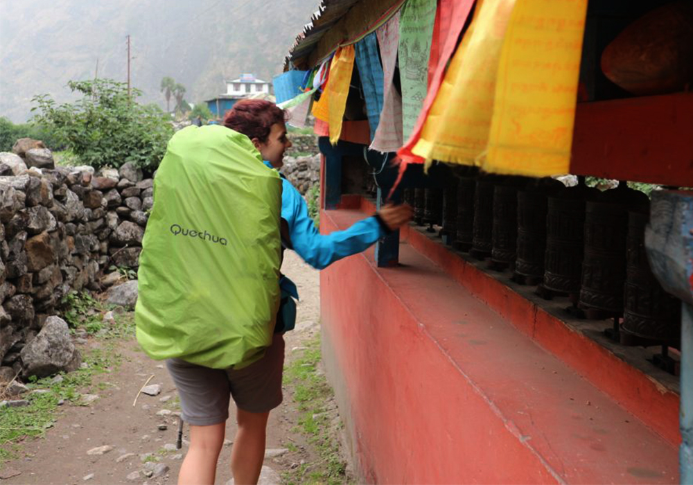
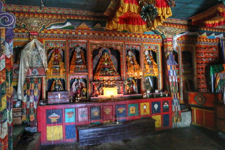
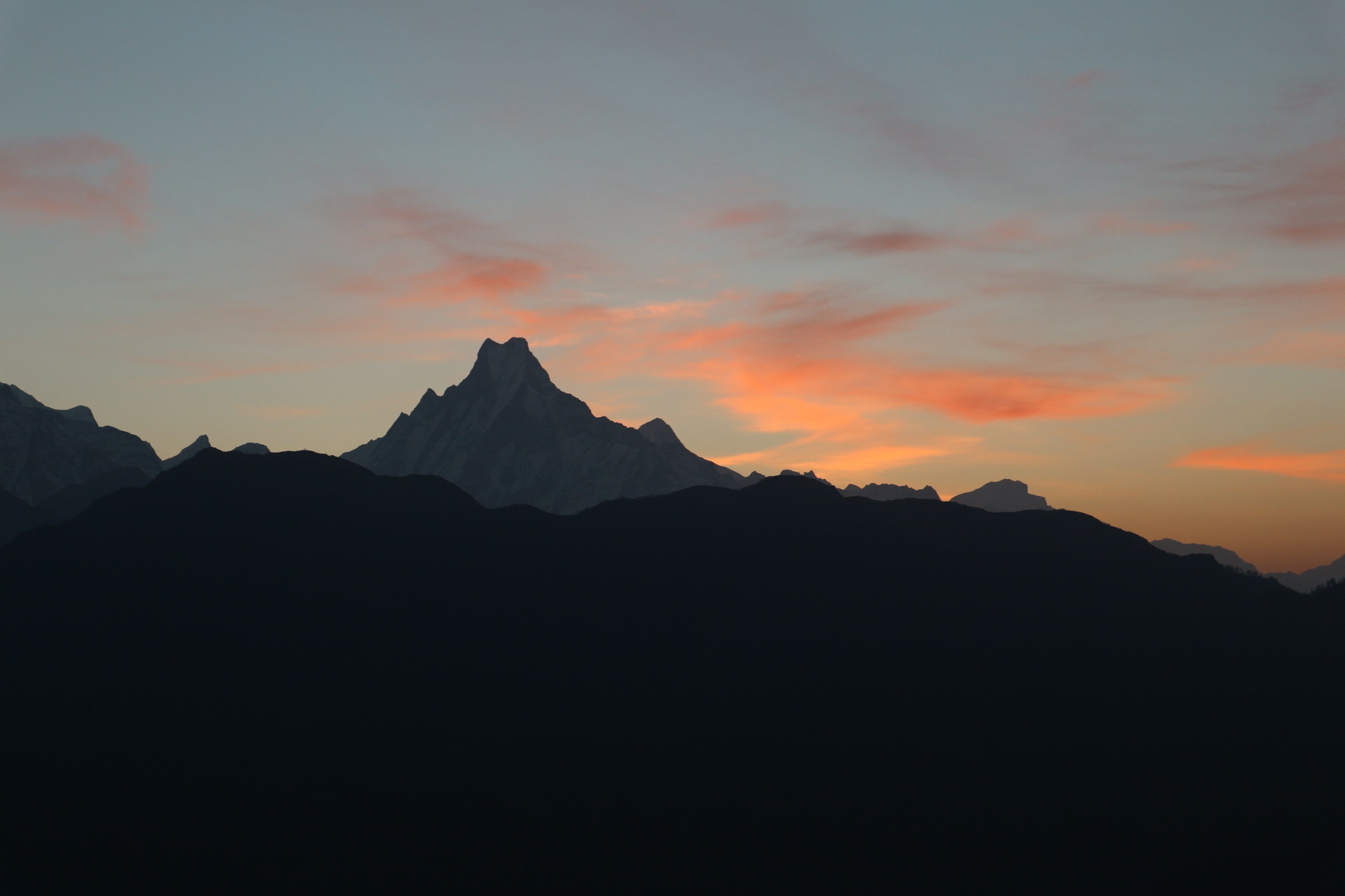
Yes, we were already a group. And even when we were considering to continue to Bagarchap instead of staying with Mingma and Thibault at Dharapani, the rain stopped us. This was maybe the only day on the trek on which the rain started so early. So staying at Dharapani allowed us to get to know each other better, visit the first budhist temple on the road and finally see the himal. When the sky was cleared from the clouds, we were really exited to see the snow peaks, the first sign of the high mountains.

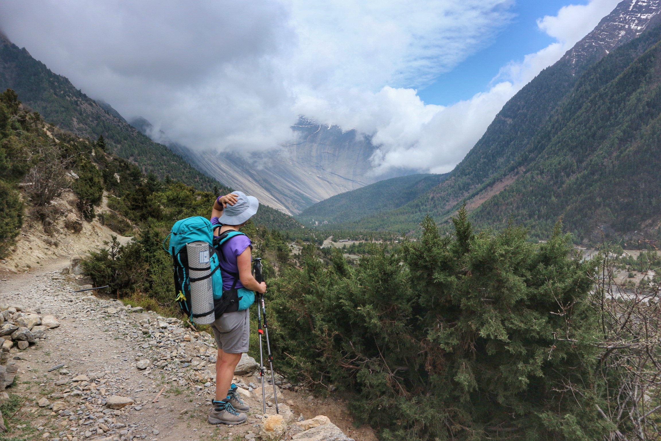
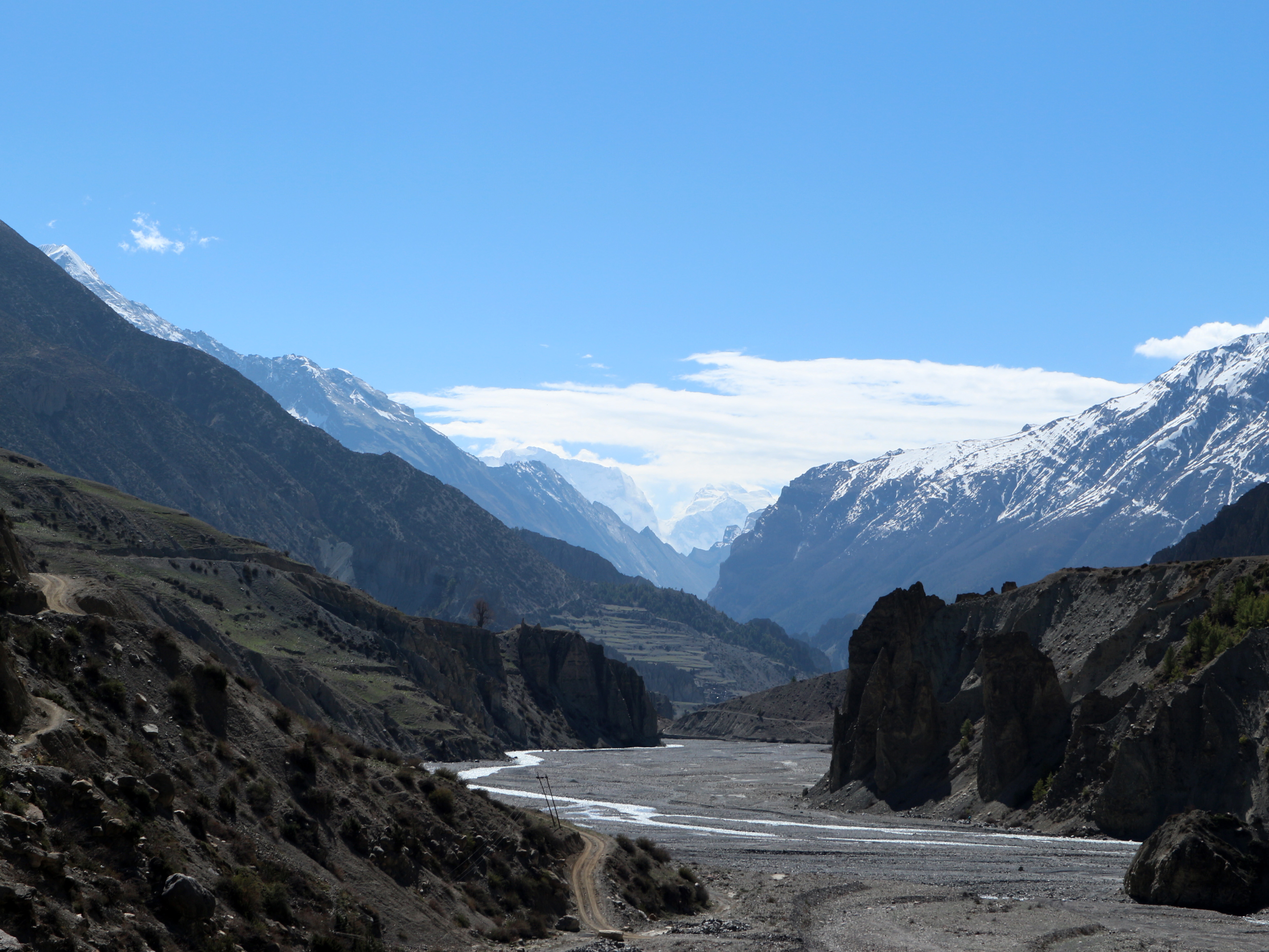
Day 4 (20.04): Dharapani (1943m) – Chame (2630m) – 16km, 1000m , 200m
Bagarchap can be reached in less than an hour after Dharapani and would have certainly been a better choice to stay for the night if it wasn’t been the rain. It is just higher and the views are better, which impresses the tourists in the early days of the trek. However, going further you anyway go higher and views get better 🙂
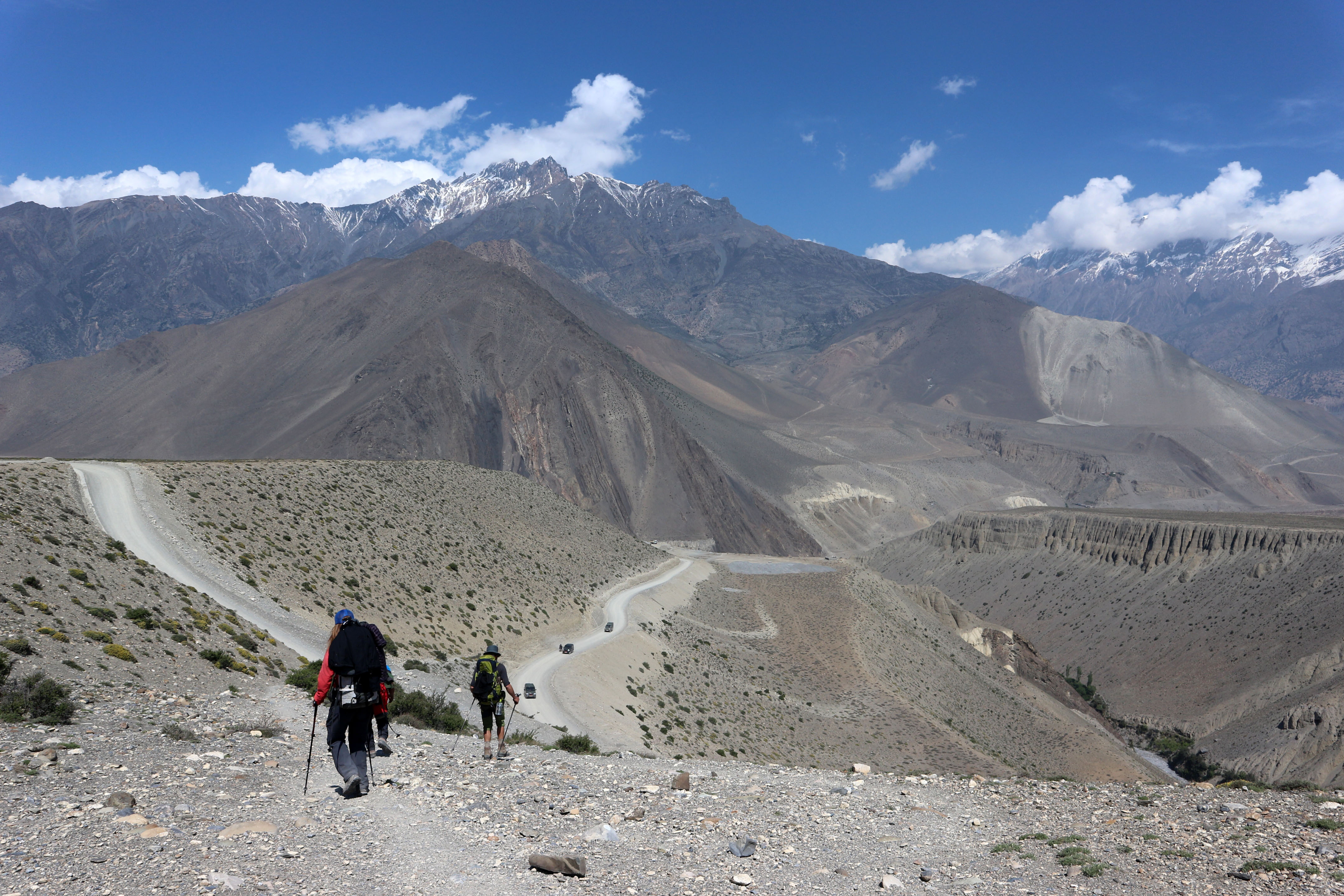
A nice place to make a break on that day is Timang (see picture below).

On the route you there are many locations, where you are asked to show your trekking permit. They are usually situated on the road or path, where it is really hard to miss them. And even if you are so distracted by the great views or deep in your thoughts, someone will surely point you to the desk.

Day 5 (21.04): Chame (2630m) – Upper Pisang (3300m) – 14km, 600m
There is certain routine in the lodges that you are slowly getting used to: on arrival you take a shower (hot if you are lucky) and do some laundry. Right after that you are asked to choose your dinner as you need to order in advance. And soon after you are enjoying your meal and maybe a beer with it, you are expected to think about food again and preorder the breakfast for the next day.
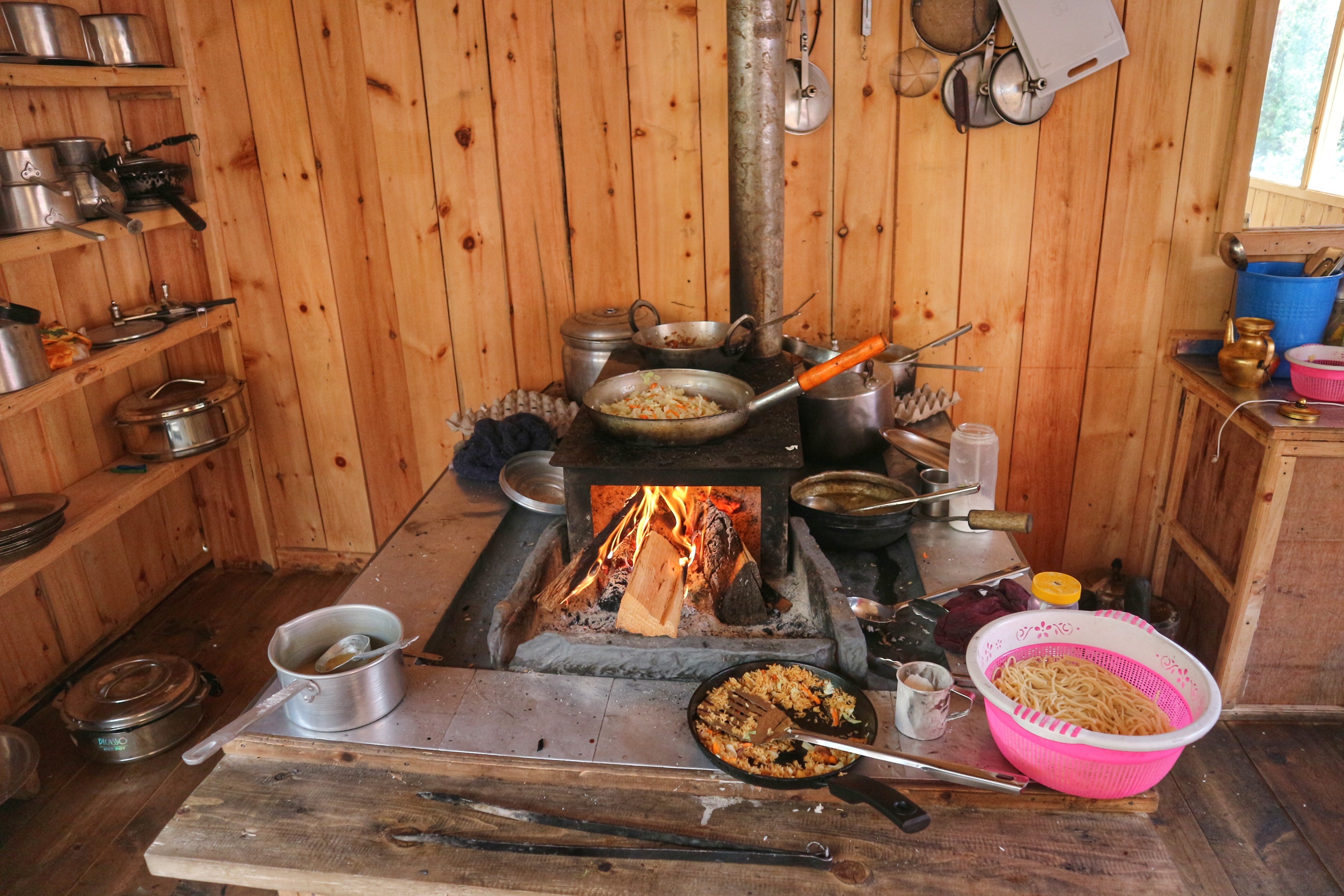
Sounds like you are thinking only about food and it is everywhere. Well, the three things on top of my list from this journey are: amazing views, perfect company and delicious food. It might have been due to the hungry eyes after several hours of walking but the taste of the food was just great: always freshly cooked with mostly homegrown ingredients.

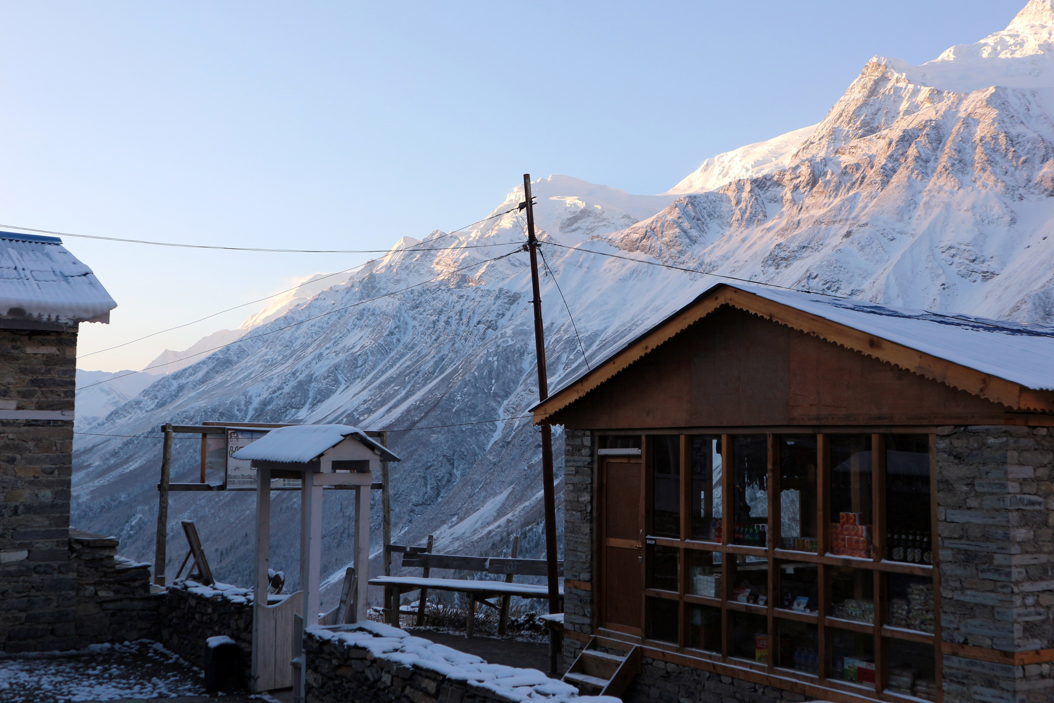
Day 6 (22.04): Upper Pisang (3300m) – Ngawal (3680m) -10km, 400m , 50m
Most people usually go directly to Manang and stay there of 2 nights. But this stony village impressed me so much that I just wanted to stay there for the night. And my Argentinian friends had already planned to sleep there. So as I said, it is great to be so flexible and be able to follow your gut feeling and decide right away „Yeah, I just feel like staying here for the night“.
And it turned out great. We found a nice lodge, left our bags and wanted to head up on a route, which climbs steeply up to the Ne Guru Cave and then continues further up in the mountain, leading to a pass at almost the same altitude as Thorung La. Our goal was of course only to do so more acclimatization and gain a better look over the village, but this rarely a good plan in the afternoon. Soon the wind was too strong and the clouds too scary, that we decided it is time to go down, drink some hot tea and play some card games.

Day 7 (23.04): Ngawal (3680m) – Ne Guru Cave (4000m) – Manang (3540m) -12km, 700m , 850m
Waking up early, just before down, is getting a daily routine. Not because you have to do so, you just don’t need much more sleep, and are eager to go out, sea the view, feel the sunrise and be ready for the next great day.

We had a delicious breakfast on the terrace of the lodge and went again on the route that we tried the day before. Lightweight and well rested, we quickly reached Ne Guru Cave (at about 4,000m), setting a personal record with this height. This acclimatization proved to be a very good choice, because we could then continue our route to Manang and sleep at about the same altitude as in Ngawal. Just like it is written in the books!


Day 8 (24.04): Manang (3540m) – Shree Kharka (4076m) -10km, 500m
Unbelievable! Streets (yes, more than just one), plenty of shops to buy some food, clothes, equipment and even souvenirs, and a bakery with cakes and an almost Italian espresso 🙂 All these small things that you have not realized that you miss until you see them.
And all these little things make Manang so exiting and a preferred place to spend several nights, doing some acclimatization treks in the area. Maybe the most common is to go to the Gangapurna Glaciers or even higher to an ice lake. Important is to not just stay there and lay down but climb higher and than sleep at the same altitude.
There is also a large choice for lodging opportunities with some larger places, which are named and even look almost like hotels.
Still, for me one night in Manang was just sufficient and I don’t regret choosing to stay in Ngwal the previous night. It has also saved me some money that I would have otherwise spent on unnecessary stuff.
The next morning was supposed to be calm and relaxed, as I was planning to do the detour to Tilicho Lake and had enough time to split it in 3 days. However, it was again full of emotions as this was the time for the first big „Goodbye“. My Argentinian friends continued the route towards Thorong La and we were not going to meet again… at least not in Nepal… this trip.
Saying Goodbye in different languages, hugging, waving and watching the people go away on another path. It always makes you sad, which is a good sign. It reminds you that you can open your heart so easily and that everything is real. It must be real when it hurts.

Shree Kharka is not really a village. It is just a place on the way with 2 lodges and a shop. But what else do you need 🙂 There is even the opportunity to take a hot shower, but as it is only one you would need to wait for it.
We (me, Ana, Mingma and Thibault) enjoyed the afternoon in the so called „Sunny room“. This is a cozy room on the second floor of the building with low banks and tables and only windows instead of walls. The perfect place for a ginger tea, black coffee and relax.

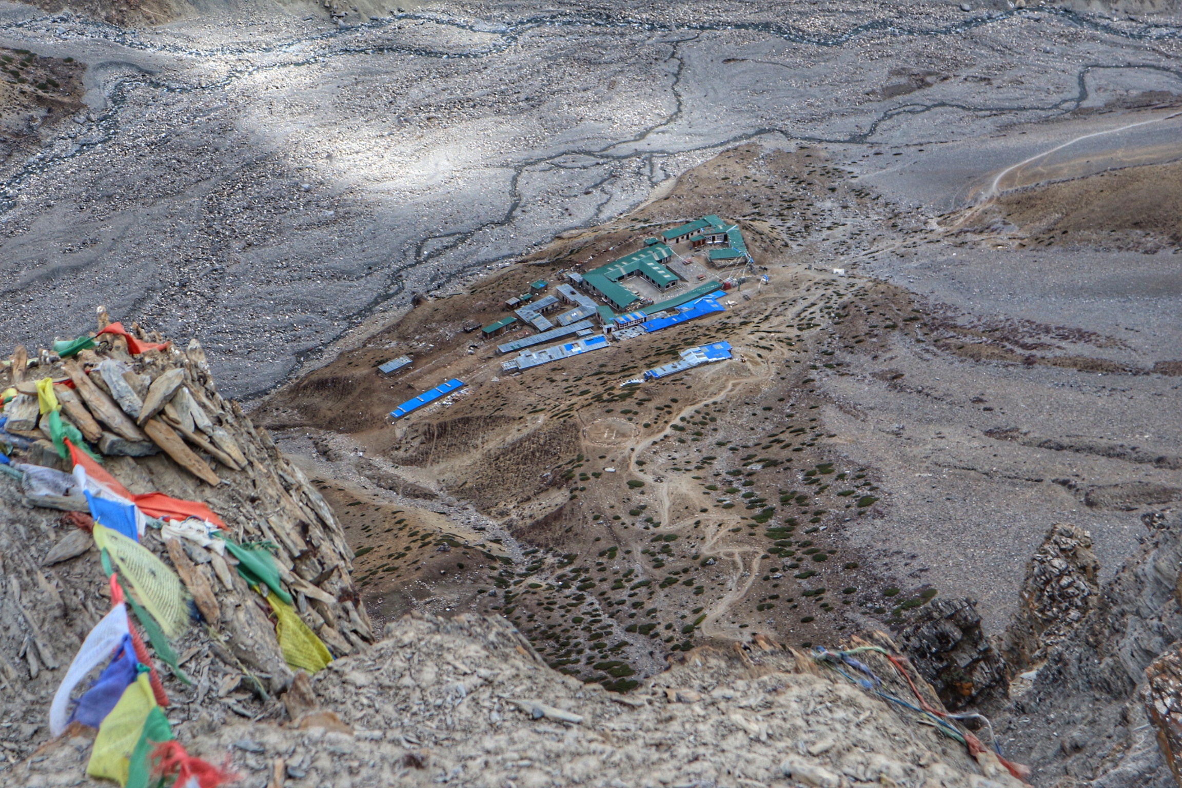
Day 9 (25.04): Shree Kharka (4076m) – Tilicho Base Camp (4150m) – 7km, 200m , 100m
As I said, I was able to invest 3 additional days on the trek for the Tilicho Lake detour. This allowed the midway stop in Shree Kharka and the comparable shorter distances for two days. The path to Tilicho Base Camp is not difficult in terms of strength and endurance, as you don’t have much deviations in altitude to deal with.
However, you cross several landslide areas, which can make things dangerous in rain or bad weather.

Day 10 (26.04): Up to Tilicho Lake (4960m) and back to Shree Kharka (4076m) – 15km, 900m , 1100m
The Tilicho Base Camp are actually 2 lodges, which are not much different from what you have experienced so far. It is just getting more expensive in the restaurant and internet and battery charging are no longer free.
Apparently, we have chosen the new one, which of course is called „hotel“. And I am happy about this choice because it brought new faces and new great friends to our group: Nicole, Marc and Romain.
And the Yatzee game started 🙂

Tilicho lake, located in Manang district– north of Annapurna massif, is the world’s highest altitude fresh water lake. So, we got up early and started our ascent before sunrise, around 6 o’clock had celebrated this victory with a thermos full of tea and a package of biscuits.


Day 11 (27.04): Shree Kharka (4076m) – Yak Kharka (4050m) – 8km, 200m , 200m
The place was familiar but the group was bigger and we had enjoyed the time close to the fire with our new friends.
It has begun to rain on the way back from Tilicho Base Camp and it even started snowing in the night. The sunrise was amazing with all these white mountains surrounding us.


Day 12 (28.04): Yak Kharka (4050m) – High Camp (4833m) – 8km, 800m
The last day before crossing the pass was not to be underestimated. It required some effort to continually gain altitude and not push it too much, as you were supposed to need all your strength on the next day.
I was progressing slowly but steadily, always at the back of the group. As Marc once said „Stefka is like a tractor – walks slowly but never stops“ 🙂 So true for me and so typically Marc.
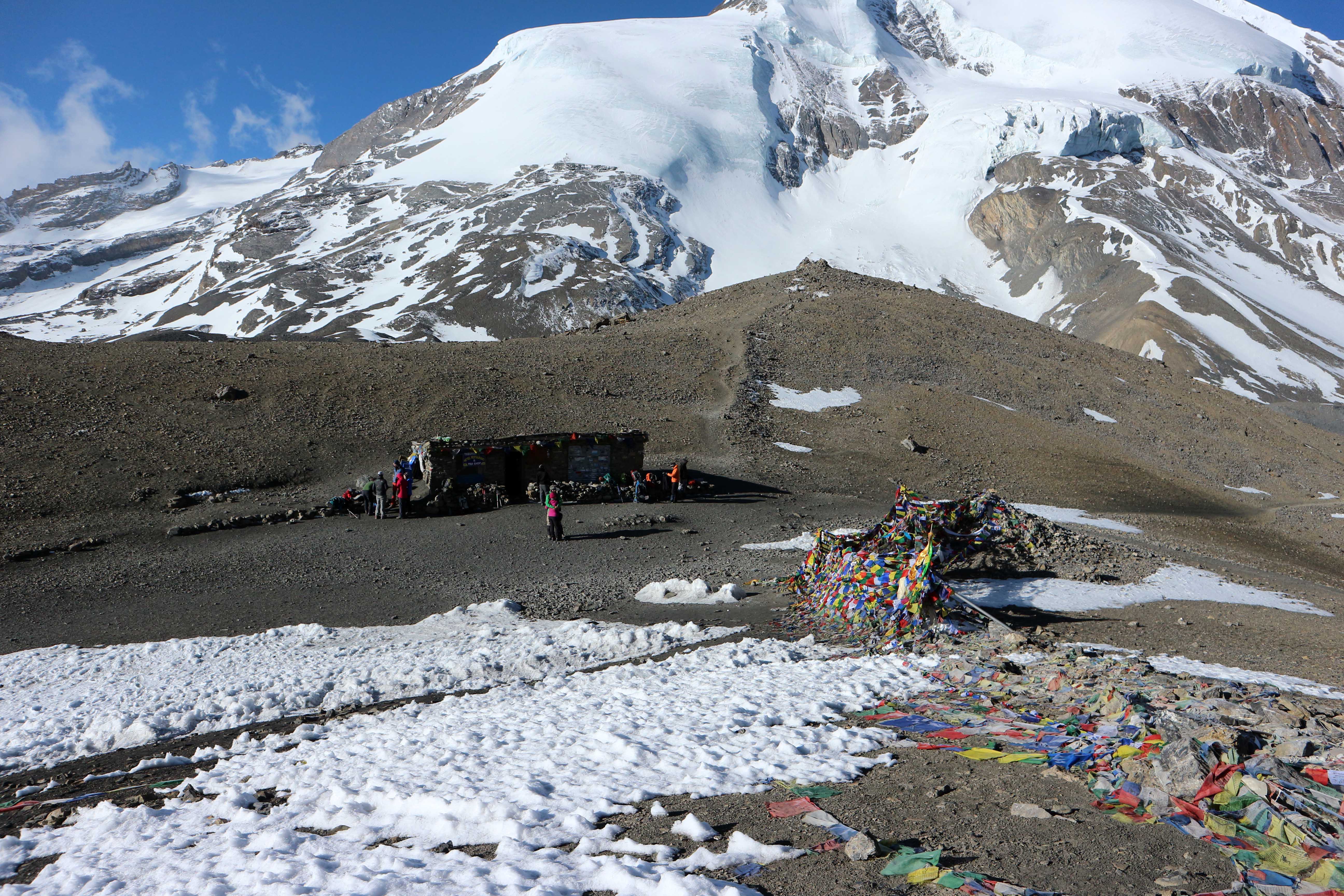
Day 13 (29.04): High Camp(4833m) – Cross Thorong Pass (5416m) and continue to Muktinath (3800m) – 14km 600m , 1600m
This was meant to be the big day. And as it often happens when you are preparing a lot and worrying about something, it goes by so quickly. And you are at the pass, the highest place ever reached (5416 m) and just think: „Was that all?“. I woke up at 4 o’clock or actually much earlier, had a quick breakfast and started the ascent at 5 o’clock. And only 2 hours later I reached the place with thousands of prayer flags which lets you no doubts that this is the famous Thorong La. Of course, a tea house opened just when we arrived. So after a cup of tea and hundreds of poses and pictures we could continue. Then it was all about going down. louds started gathering as soon as we left and proved that the early start pays off.


Day 14 (30.04): Muktinath(3800m) – Kapgeni – Jomsom (2720m) – 19km, 920m
When we arrived at Muktinath the sun was shining and it felt so warm that we were all tempted to drink a well deserved beer at the terrace of our hotel. We took some rest and then used the afternoon to walk around the town and visit the holy places and beautiful temples, which make it so famous and visited by many pilgrims.


Day 15 (o1.05): Bus from Jomson to Tatopani
Definitely the most extreme bus rides that I have ever had. The 43km took about 4 hours and you really don’t want to look outside the window. The road is so narrow but there are buses and trucks in both directions.


Day 16 (02.05): Tatopani (1200m)- Ghorepani (2870m) – 17km, 1670m


Day 17 (03.05): Ghorepani (2870m) – Poon Hill (3200m) – Deurali Pass (3090m) – Ghandruk (1940m) – Landruk (1565m) – 20km, 1400m , 2600m
You go up at 4 o’clock but the lodge and all other nearby hotels and lodges are already quiet busy. People with headlamps are packing their bags and rushing to the start of the foothill trek. Hundreds of people line up on the trail, which looks more like a staircase to some amusement park attractions. To make the comparison even more real, there is also an entrance gate, where you are asked to pay a fee.


Day 18 (04.05): From Landruk (1565m) to Phedi (1100m) and bus/taxi to Pokhara – 15km, 600m , 1000m
On the way down form Landruk to Phedi you cross paths with many other people, usually starting the ABC trek or doing just a one day hike from Pokhara.


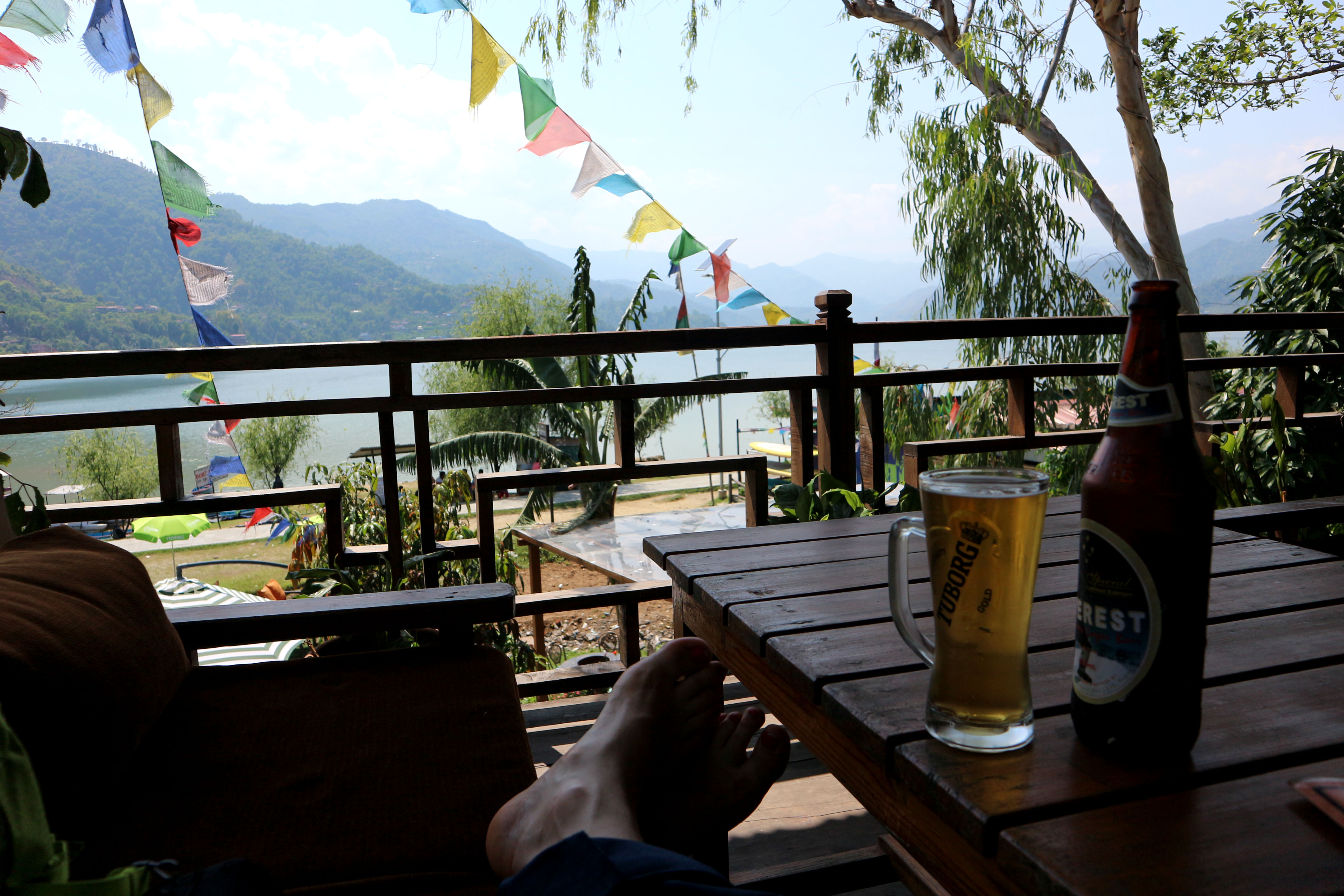
Day 19 (05.05): Relaxing in Pokhara


Day 20 (06.05): Bus to Kathmandu
Again the 200km distance would take you the whole day by bus – at least 9 or 10 hours.
Day 21 (07.05): Visited Bakhtapur and Patan


Departure (08.05) Goodby Kathmandu
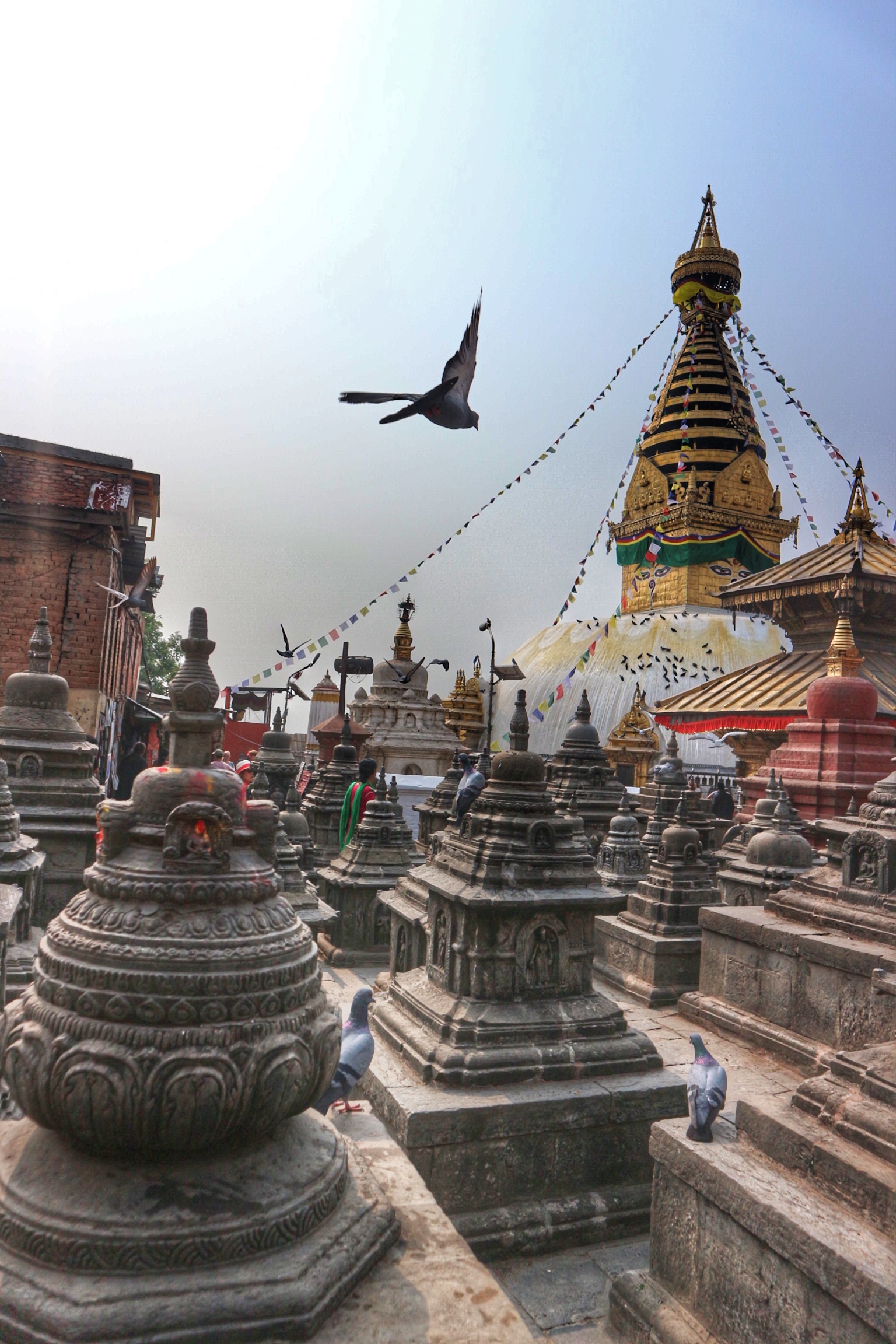
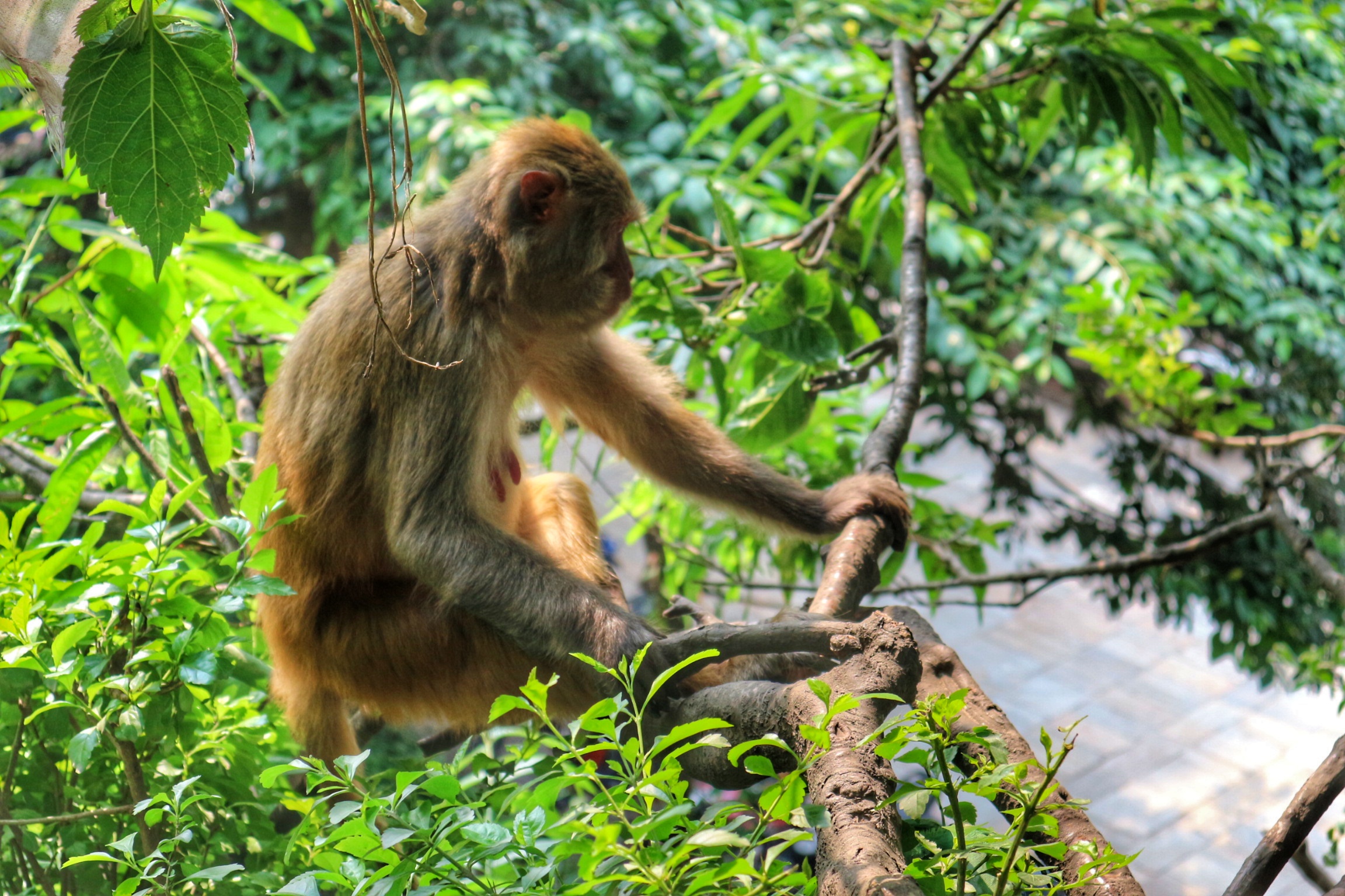
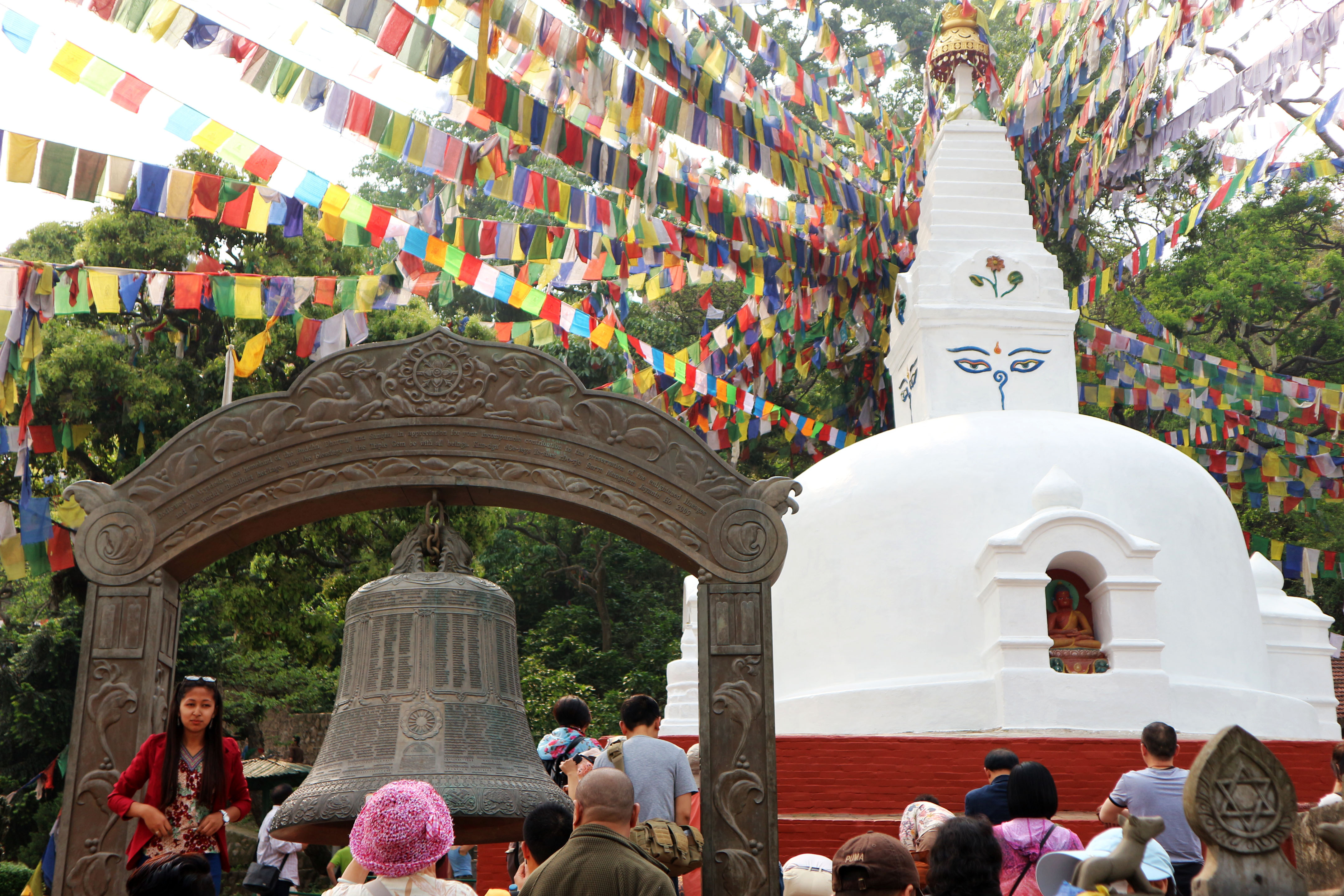
I had a late flight, allowing me to walk to Swayambhunath (or also known as the Monkey Temple) in the morning.

Няма такъв як блог!
Супер готино!
Благодарности 🙂 Има още много работа по него, защото искаме да споделим толкова много неща и да сме полезни с повече информация. Но както казват… трябва да започнеш и да вървиш в избраната посока, дори и с малки стъпки 🙂